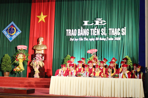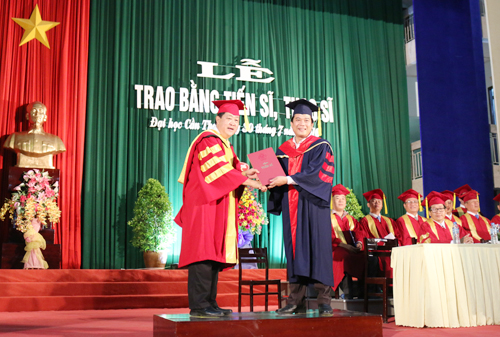
Tên đề tài: “Phân tích mối quan hệ giữa các yếu tố kinh tế - xã hội - môi trường làm cơ sở xây dựng mô hình tích hợp hỗ trợ quy hoạch sử dụng đất nông nghiệp. Trường hợp nghiên cứu tại tỉnh Sóc Trăng”.
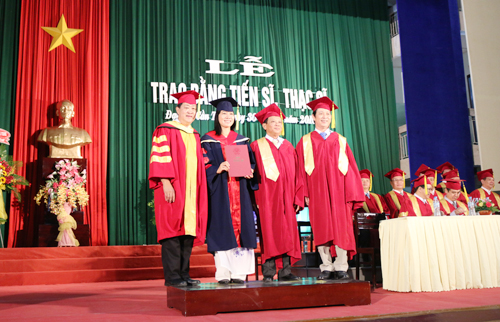
Tác giả: Nguyễn Hồng Thảo, Khóa: 2015
Chuyên ngành: Quản lý đất đai; Mã số: 62850103. Nhóm ngành: Môi trường và bảo vệ môi trường.
Người hướng dẫn chính: PGS.TS. Nguyễn Hiếu Trung - Trường Đại học Cần Thơ.
- Tóm tắt nội dung luận án
Trong quy hoạch sử dụng đất nông nghiệp để tìm ra phương án tốt cần thực hiện nhiều đánh giá bố sung về kinh tế, xã hội và môi trường (KT-XH-MT). Tuy nhiên, hiện nay còn thiếu các công cụ tổng hợp để hỗ trợ công tác này. Luận án được thực hiện với mục tiêu phân tích các yếu tố KT-XH-MT ảnh hưởng đến quyết định sử dụng đất đai làm cơ sở xây dựng mô hình tích hợp hỗ trợ xây dựng các phương án tối ưu hóa và bố trí đất sản xuất nông nghiệp.
Phương pháp thực hiện được dựa trên phân tích điều tra các yếu tố KT-XH-MT được chọn lọc trên 315 hộ dân với 7 kiểu sử dụng (KSD) chính ở địa phương nghiên cứu gồm Ba vụ lúa, Hai vụ lúa, Hai vụ lúa - Màu, Lúa –Tôm, Chuyên màu, Câu ăn quả, Chuyên Tôm. Mô hình tích hợp được xây dựng dựa trên nhiều phương pháp trong đó công cụ tối ưu hóa dựa trên phương pháp tối ưu hóa tuyến tính một mục tiêu hay nhiều mục tiêu; Giá trị ràng buộc trong phương trình tối ưu hóa được dự tính bằng phương pháp Monte Carlo; Kết quả dự tính được bố trí trên bản đồ theo phương pháp bố trí Cellula Automata và đánh giá đa tiêu chí trên phần mềm GAMA.
Kết quả thống kê các yếu tố KT-XH-MT của luận án được phân thành 2 nhóm: (i) nhóm các yếu tố phù hợp cho tối ưu hóa diện tích các KSD gồm: lợi nhuận, thích nghi tự nhiên, lợi nhuận, lao động, mức rủi ro, tác động tốt cho môi trường; (ii) Nhóm các yếu tố dùng cho bố trí không gian các KSD gồm: khả năng đầu tư, hạ tầng giao thông, kênh rạch, yêu cầu được bố trí lân cận nhau.
Trên cơ sở các yếu tố KT-XH-MT đã xác định được cho từng công đoạn, luận án đã xây dựng mô hình tích hợp ST-IALUP gồm có 3 công cụ: (i) Công cụ dự tính diện tích các kiểu sử dụng trong tương lai làm điều kiện biên cho tối ưu hóa diện tích. (ii) Xây dựng mới được phần mềm đặt tên LandOptimizer chuyên dùng để hỗ trợ giải bài toán tối ưu hóa sử dụng đất nông nghiệp. Trong tối ưu hóa đa mục tiêu, phần mềm cho phép người dùng duyệt tự động các bộ trọng số mục tiêu giúp đánh giá tổng thể các phương án phù hợp; (iii) Xây dựng được mô hình bố trí đất nông nghiệp lên bản đồ từ nguồn dữ liệu đầu vào là diện tích tối ưu cần bố trí lên các bản đồ đơn vị đất đai.
Kết quả ứng dụng mô hình tích hợp ST-IALUP cho trường hợp nghiên cứu tại 3 huyện Long Phú, Mỹ Xuyên và Trần Đề thuộc tỉnh Sóc Trăng với hai kịch bản và 3 phương án cho mỗi kịch bản. Trong đó, hai kịch bản với phương án tối ưu lợi nhuận đều đạt giá trị lợi nhuận cao nhất. Tuy nhiên giá trị lợi nhuận cao hơn này không đáng kể so với khả năng rủi ro khi chạy theo lợi nhuận. Do đó, phương án tối ưu hóa đa mục tiêu là phương án được lựa chọn để thực hiện bố trí đất đai lên bản đồ. Kết quả bố trí đất đai được thực hiện có liên quan đến các yếu tố về năng năng lực kinh tế nông hộ, ảnh hưởng của kiểu sản xuất lân cận, hệ thống giao thông và kênh rạch để kết quả bố trí đất sản xuất nông nghiệp phù hợp nhất với tình hình thực tế nhằm đảm bảo hài hòa giữa lợi nhuận và giảm thiểu rủi ro cũng như ảnh hưởng không tốt đối với môi trường.
- Những kết quả mới của luận án
Xây dựng được mô hình tích hợp phục vụ quy hoạch sử dụng đất dưới tác động của các yếu tố KT-XH-MT có tên ST-IALUP. Mô hình gồm 3 thành phần: (1) Mô hình dự tính diện tích các KSD; (2) Chương trình phần mềm tối ưu hóa diện tích sử dụng đất LandOptimizer; (3) Mô hình bố trí đất sản xuất nông nghiệp ST-LUAM.
Kết quả thứ nhất trong mô hình tích hợp là mô hình dự tính diện tích các KSD dựa trên dữ liệu diện tích canh tác lịch sử và phương pháp tính Monte Carlo. Ứng dụng mô hình này đã xác định được diện tích canh tác ràng buộc cho tối ưu hóa diện tích đất trồng cây ăn quả, cây hàng năm và đất nuôi thủy sản.
Luận án đã xây dựng mới được chương trình phần mềm được đặt tên LandOptimizer được tích hợp trong ST-IALUP. Phần mềm này cho phép lập mô hình tối ưu hóa và tính toán diện tích tối ưu cho hệ thống sử dụng đất với các hàm tối ưu hóa một mục tiêu gồm lợi nhuận, tối ưu hóa lao động hoặc hàm tối ưu hóa đa mục tiêu lợi nhuận, lao động, giảm thiểu rủi ro và môi trường. Dựa trên chức năng của phần mềm, người quản lý khảo sát được tất cả các bộ trọng số mục tiêu có thể để làm cơ sở lựa chọn phương án.
Giải quyết được bài bài bố trí các KSD khác nhau trong một đơn vị đất đai qua mô hình ST-LUAM mới đề xuất. Trong đó các KSD có cạnh tranh được ưu tiên xem xét theo các tiêu chí về chỉ số lân cận, gần đường giao thông, gần kênh rạch, khả năng đầu tư của xã.
Kết quả ứng dụng mô hình tích hợp trong trường hợp nghiên cứu ở 3 huyện Long Phú, Mỹ Xuyên và Trần Đề, tỉnh Sóc Trăng đã cho thấy phương án tối ưu đa mục tiêu trong cả 2 kịch bản là phương án được lựa chọn do hài hòa giữa lợi nhuận và giảm thiểu rủi ro cũng như ảnh hưởng không tốt đối với môi trường.
- Các khả năng ứng dụng trong thực tiễn, các vấn đề cần tiếp tục nghiên cứu
Kết quả đạt được của luận án là đã xây dựng là công cụ hỗ trợ cần thiết trong lập quy hoạch sử dụng đất sản xuất nông nghiệp, giúp nhà quy hoạch có được công cụ hỗ trợ ra quyết định và nâng cao chất lượng các phương án quy hoạch sử dụng đất nông nghiệp.
Mô hình tích hợp ST-IALUP cần được triển khai ứng dụng ở các vùng có điều kiện thủy lợi khác nhau cũng như có sự đa dạng các kiểu sử dụng đất nhằm tiếp tục được hiệu chỉnh phù hợp với điều kiện thực tế.
Bên cạnh đó, công tác dự tính dự báo những thay đổi trong tương lai của các yếu tố KT-XH-MT là rất cần thiết cho công tác quy hoạch sử dụng đất. Do đó cần phải tiếp tục nghiên cứu mở rộng nghiên cứu trên nhiều kiểu sử dụng đất đai khác nhau để mô hình tích hợp ST-IALUP hỗ trợ tốt hơn cho công tác quy hoạch sử dụng đất đai.
- Summary of the dissertation
In agricultural land use planning, to find a good plan, it is necessary to carry out many additional economic, social and environmental assessments. However, there is currently a lack of integrated tools to support this work. The thesis is carried out with the aim of analyzing socio-economic factors that affect the decision to use the land as a basis for building an integrated model for the construction of optimization options and agricultural land allocation.
For analyzing the socio-economic and environmental factors, 315 households have been surveyed on selected factors for 7 land-use types in the study area including three rice crops, two rice crops, two rice crops - vegetable, Rice - Shrimp, Vegetable, Fruit, Shrimp. The surveyed data was analyzed using the descriptive statistic method. The integrated model was built with different methods in which the optimization tool was based on the linear optimization method for one or many objectives optimization; The constraint values in the optimization equation was estimated by using the Monte Carlo method; Optimized area for each land use type was arranged on the map by Cellular Automata method and Multi-criteria evaluation on GAMA modeling platform.
The statistical results of the thesis showed that there are 2 groups of factors affecting land use decision and land use arrangement. (i) The first group of factors influencing to land use optimization including land suitability, profit, labor, risk level, impact level for the environment; (ii) The second group impacting spatial arrangement of land use composed investment capacity, local transportation, canal systems and requirements to be arranged adjacent to each other.
Based on the identified socio-economic factors, an integrated model so call ST-IALUP has been built including 3 tools: (i) The tool for estimating area of different types for the future that will be used to estimate the constraint boundary for optimization. (ii) A new application software named LandOptimizer has been built that can be exclusively used to support solving problems of optimizing agricultural land use. In multi-objective optimization, the software allows users to automatically explore objective weights to exhaustively assess appropriate options. (iii) A model of agricultural land use allocation for land use plan mapping based on the input data from the LandOptimizer.
Results last but not least showed the result of a case of study where the ST-IALUP integrated model was applied for land use solutions mapping in districts of Long Phu, My Xuyen and Tran De of Soc Trang province. In this case study, two scenarios of land use for 2030 in normal condition and under climate change condition. In each scenario, 3 options of optimization have been tested such as land suitability, profit and multi-objective (profit, labor, environmental level, risk level). In two scenarios, the profit-maximizing plan has the highest profit value and the lowest is the land adaptation option. However, the value of this higher profit is negligible compared to the risk of running after profit. Therefore, multi-objective optimization was the considered option to implement land use plan. The land allocation was carried out taking into account factors of household economic capacity, the influence of adjacent production types, local transportation and canal systems so that the results of agricultural land allocation are suitable. Consolidated with the actual situation.
Based on the case of study, the thesis proposed a process to apply the integrated model in developing land use planning plans taking into account socio-economic factors.
- New findings of the thesis
Socio-economic and environmental factors affecting land use and agricultural land development in the study area of Soc Trang province identified for 3 ecological regions: fresh, saline and brackish water regions. Socio-economic and environmental factors are divided into 2 groups: The group of factors influencing land use optimization includes land suitability, profitability, labor force, risk in cultivation and a good impact on the environment; the group of factors includes investment capacity, transport infrastructure, canals, the need to be located next to each other, those affect the arrangement of land use.
An integrated land use planning model under the impact of socio-economic factors called ST-IALUP was built. The model comprises 3 components: (1) Model for estimating the area of the LUTs; (2) LandOptimizer software for land optimization software program; (3) ST-LUAM model for agricultural land arrangement.
The first output of the integrated model was the model for estimating the area of LUTs on the basis of historical data on cultivated areas and the Monte Carlo calculation method. The application of this model identified the linked cultivated area for the optimization of the area of fruit trees, annual crops and aquaculture land.
New software called LandOptimizer integrated in ST-IALUP has been built. This software enables land use optimization and calculation optimum area for land-use systems with single objective optimization functions including profitability, workforce optimization or the multi-objective optimization function. profitability, work, risk reduction and the environment. Based on the functionality of the software, the manager can examine all possible target weights as a basis for selecting options.
Solve the problem of the arrangement of the different LUTs in a land unit thanks to the new ST-LUAM model proposed. In which, the competitive LUTs are prioritized according to the criteria of neighborhoods, proximity to roads, proximity to canals and the municipality's investment capacity.
The results of the integrated model in the case study in 3 districts of Long Phu, My Xuyen and Tran De, Soc Trang province showed that the optimal plan for the target in the two scenarios is the one chosen because of the harmonization between profitability and risk reduction as well as a negative impact on the environment.
- Applicability
With the achieved results showed in the dissemination, the socio-economic, environmental factors and the integrated model could be used as a decision-supporting tool for the land use planning process that can help planners to improve the quality of agricultural land use plans.
The issues for further research:
The ST-IALUP integrated model needs to be deployed in areas with different irrigation conditions as well as with a variety of land use patterns to continue to be adjusted to suit the actual conditions.
In addition, the forecasting of future changes in socio-economic factors is essential for land use planning. Therefore, it is necessary to continue research to expand research on many different land use types so that the ST-IALUP integrated model better supports land use planning.
- Xem chi tiết nội dung luận án
- Xem thông tin đăng tải tại Website Bộ giáo dục và Đào tạo. (Nhập tên NCS vào ô tìm kiếm)

